Overview
Tawang, the beautiful land of the people of Monpa Tribe, is located in the Western-most part of the state Arunachal Pradesh bounded by Tibet (China) to the north, Bhutan to the south-west and Sela ranges separated from West Kameng district in the east.
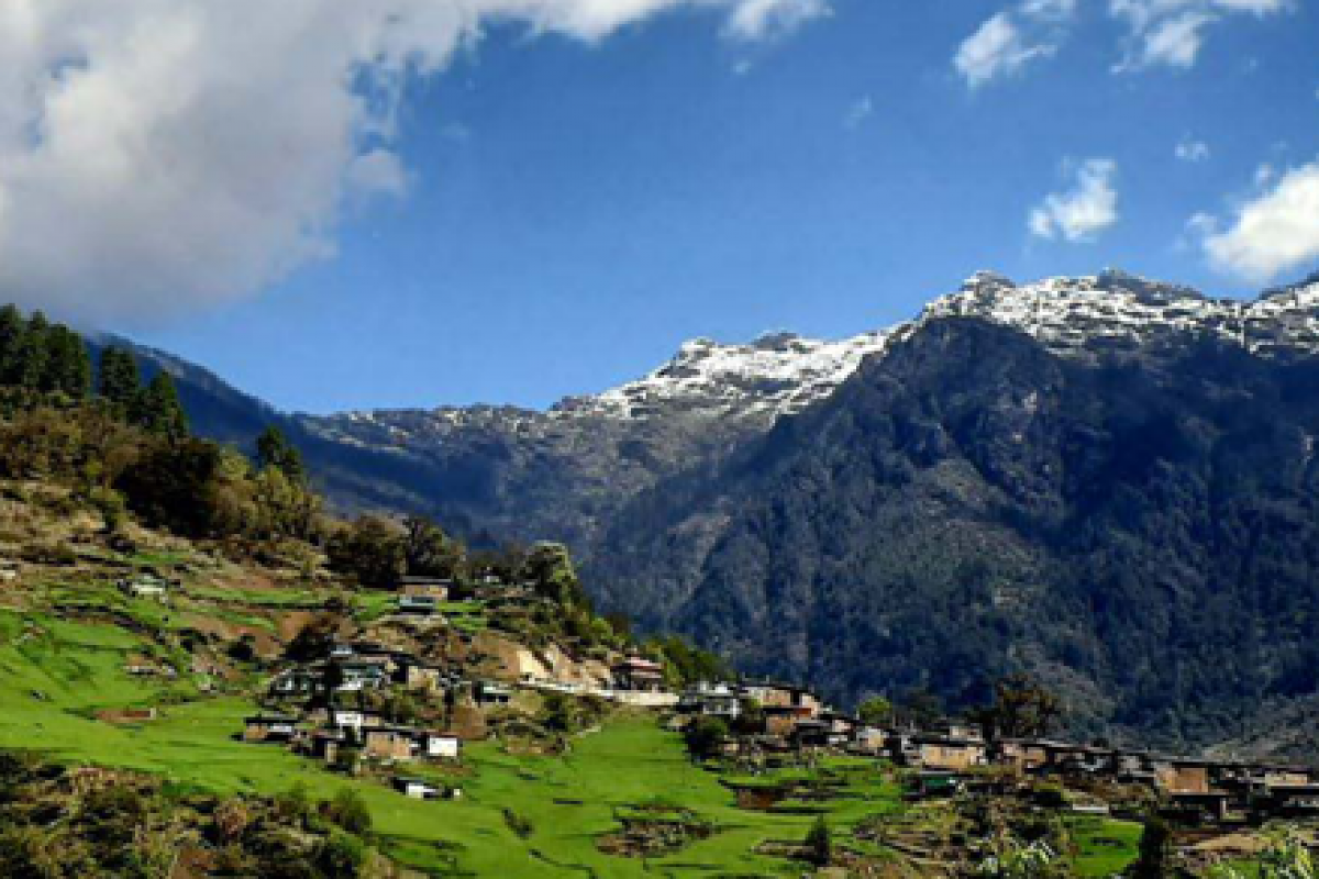
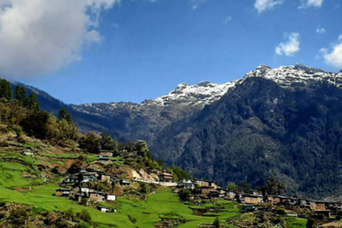
The district is entirely located amongst the mighty Himalayas and has a rugged terrain with deep valleys and altitude ranging between 3,500 to 22,500 feet. Its snow- capped peaks, pleasant lakes, congenial cli-mate, friendly and hospitable people continue to entice the people who visit.
This magical land evokes images of awesome mountain views, remote hamlets, quaint and sleepy villages, magical Gompas, tranquil lakes and mesmerizing mountains.
Tawang rightly called ‘Paradise on Earth’, is a small picturesque town tucked away in the lap of the eastern Himalayas.
Tawang derives its name from the majestic Tawang Monastery. Tawang has an average eleva-tion of 2,669 metres (8,757 ft).
Tawang was earlier an indepen-dent kingdom by the name of ‘Monyul’, which eventually came under the administrative control of Tibet. As a result of the draw-ing up of the Macmohan Line by Sir Henry Macmohan in 1914 at the Shimla Convention, Tibet had to give up its control over Tawang and several hundred square miles of its territory to British India.
India attained her independence from Britain in 1947 and Tawang continued to be a part of India. The year 1950, witnessed the fateful march of the Chinese Peo-ple’s Liberation Army into Tibet. This was a watershed in the his-tory of Tibet as well as Tawang. The Government of India realized the probability of a possible Chinese aggression in Tawang and gave due cognizance to the strategic importance of this region. Under the direction of New Delhi, Major Ralengnao ‘Bob’ Khating of the Indian Frontier Administration Service hoisted the tricolor for the first time in Tawang in February, 1951 and established Indian control.
During the Chinese aggression of India in 1962, China occu-pied Tawang for a short period. After the retreat of the Chinese troops, India regained control of Tawang. Since then, Tawang has remained an integral part of India and elections are held regularly to send democratical-ly elected members to the leg-islature.
The War memorial of Jaswant Garh at Nuranang in Tawang dis-trict, is dedicated to the memory of Rifleman Jaswant Singh Rawat, Mahavir Chakra awardee of the 4th Battalion of Garhwal Rifles In-fantry Regiment who stuck to his post and fought the marauding Chinese invaders single -handed-ly for three days during the final phase of the Indo-China war in November, 1962.
It is believed that he was killed by the Chinese, who cut off Jas-want Singh’s head and took it with them to China. However, after the ceasefire, the head was returned along with a brass buss of Jaswant Singh.
This same bust is installed at the sight of the battle, now known as Jaswant Garh.
Six personnel are engaged round the clock at Jaswant Garh, to take care of Jaswant Singh and his memorial. They make his bed, polish his shoes, iron his clothes and deliver his fan mails. They cook for him and serve him bed tea, breakfast and dinner at stipu-lated timings. He also gets his leave and salary as is due to a living soldier.
The locals and the soldiers firmly believes that Jaswant Singh’s spirit roams the area and protects them from harm and danger.
The Tawang district, with eleva-tions ranging between 6000 to 22,000 feet, occupies an area of 2,172 sq. km. It is connected to Tibet by the Bumla and Tulung la passes. The road across Bumla reaches right up to Lhasa. The district has four towns, viz., Lumla, Jang, Tawang and Zemithang,
The topography of the district can be classified in two parts, the mostly uninhabited and barren snow -covered Himalayan range from 11,000 ft to 22,000 ft and the high -altitude, mountainous belt from 6000 ft to 11,000 ft. The latter mainly consists of sparsely populated plateaus and narrow valleys. Due to the sudden chang-es in the terrain there are varia-tions in the climatic conditions within short distances.
A major part of the Tawang dis-trict falls under the Higher Hima-layan region and experiences severe winters and snowfall. However, the remaining portion that falls in the lesser Himalayan region, experiences cool climate.
The maximum and minimum temperature of Tawang are 29 degree C and 6.5 degree C in summers and 15 degree C and -5 degree C in winters respectively. The average annual rainfall is 2760 mm.
Gaden Namgyal Lhatse Majesti-cally perched at a height of 10,000 ft, the grand Tawang Monastery is the supreme foun-tainhead of the religious life of the Monpas.
Tawang Monastery also known as Gaden Namgyal Lhatse, is four hundred years old Mahayana Monastery of the Gelupa faction was founded by Merak Lama Lodre Gyatso in the seventh month of the Iron Monkey year i.e., in 1680 and was completed in the eight month of the Iron Bird year i.e., in 1681. Merak Lama constructed the monastery as per the wishes of His Holiness, the 5th Dalai Lama, Ngawang Lobsang Gyatso.
The Tawang Monastery is an important centre for Buddhist learning and cultural studies. Here young monks are taught Bhoti, Arithmetic, English and Hindi besides traditional mo-nastic education.
The monastery is home to more than ve hundred monks. The gompa throbs with activity, with the hundreds of monks inces-santly chanting mantras, pray-ing, reciting Holy Scriptures and advancing Buddhist philosophy and thought.
THE MONPAS
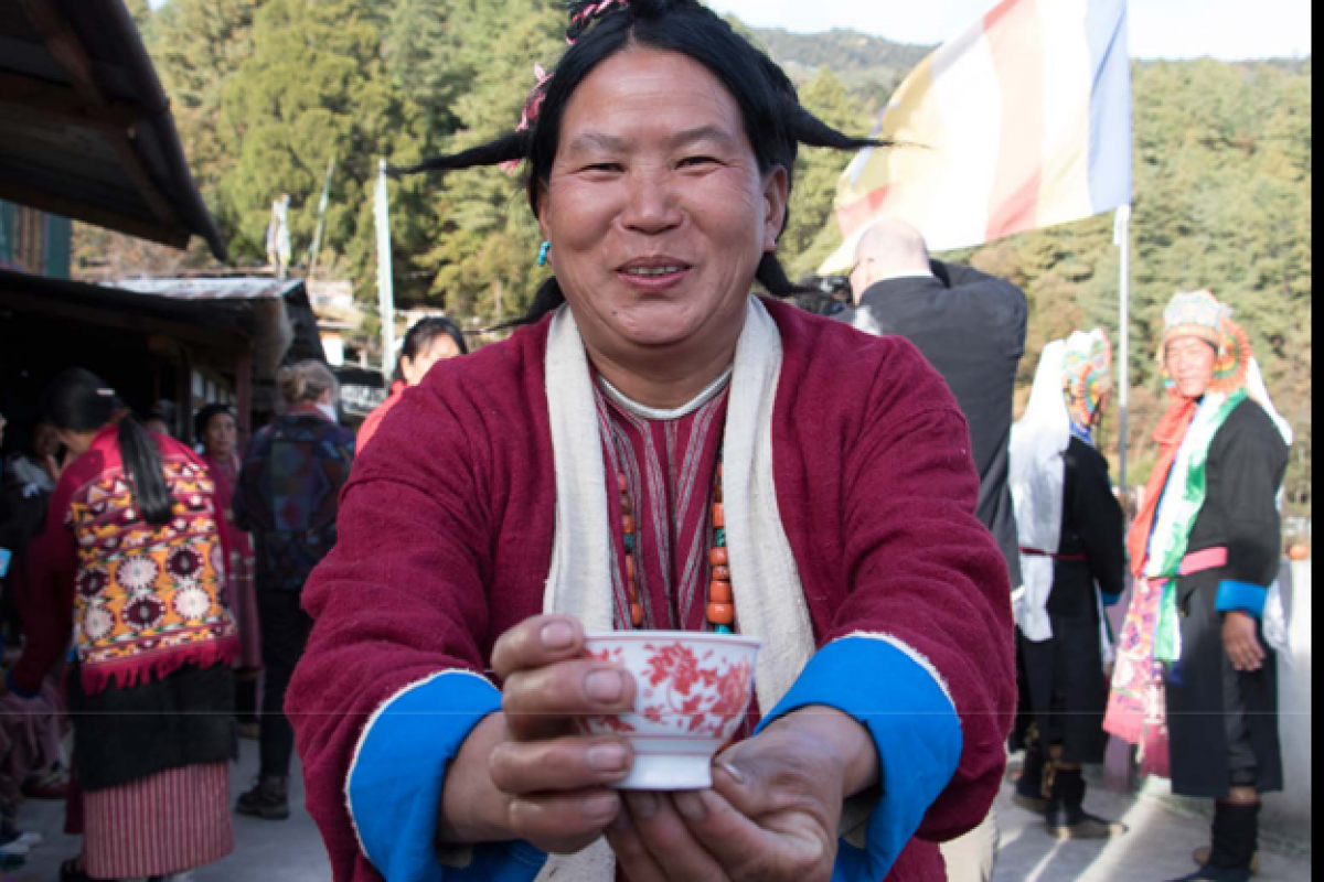
The Monpas belong to the Tibe-to-Mongoloid racial stock and are one of the major communities of Arunachal Pradesh. They are the larg-est tribe in Tawang district.
The Monpas are very friendly courte-ous, gentle, hospitable and fun loving people. They are great lovers of music. They love to sing, dance and play various musical instruments. Their musical instruments can be di-vided into different types : religious
& secular, metallic and non-metallic and wind instruments.
FESTIVALS
The Monpas have a year-long calen-dar of colourful festivals that bear testimony to their rich and lively cul-tural heritage. Their festivals are characterized by fun, felicity, feasting, praying and performance of an as-sortment of religious rituals. They celebrate several important festivals such as Losar, Saga Dawa, Dukpa Tse-shi, Lhabab Duechen, Torgya, Ganden Ngamchoe, and others. Losar in Tibetan means “New Year”. This festival, which heralds the onset of the New Year, predates Bud-dhism in Tibet. Losar is the most important festival in Tawang, and is celebrated by the Monpas for 15 days, in the first month of Dawa Dangpo, which normally coincides with the end of February or early March.
PASSES & PEAKS
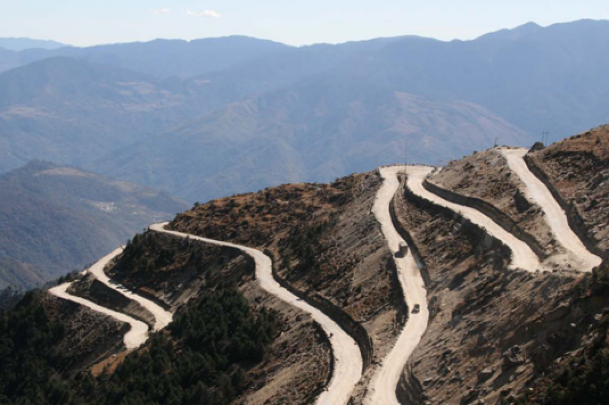
Sela Pass :
With a height of around 13,700 ft, the Sela Pass is one of the world’s highest motor-able passes. With its brilliant snow -laden mountains, the fir trees and the tranquil and deep lakes, it is indeed a breathtaking and apt gateway to the Hidden Paradise.
The surreal hues of the sky above, the placid waters of the lake below and the exquisite landscape all around, make Sela Pass truly remarkable.
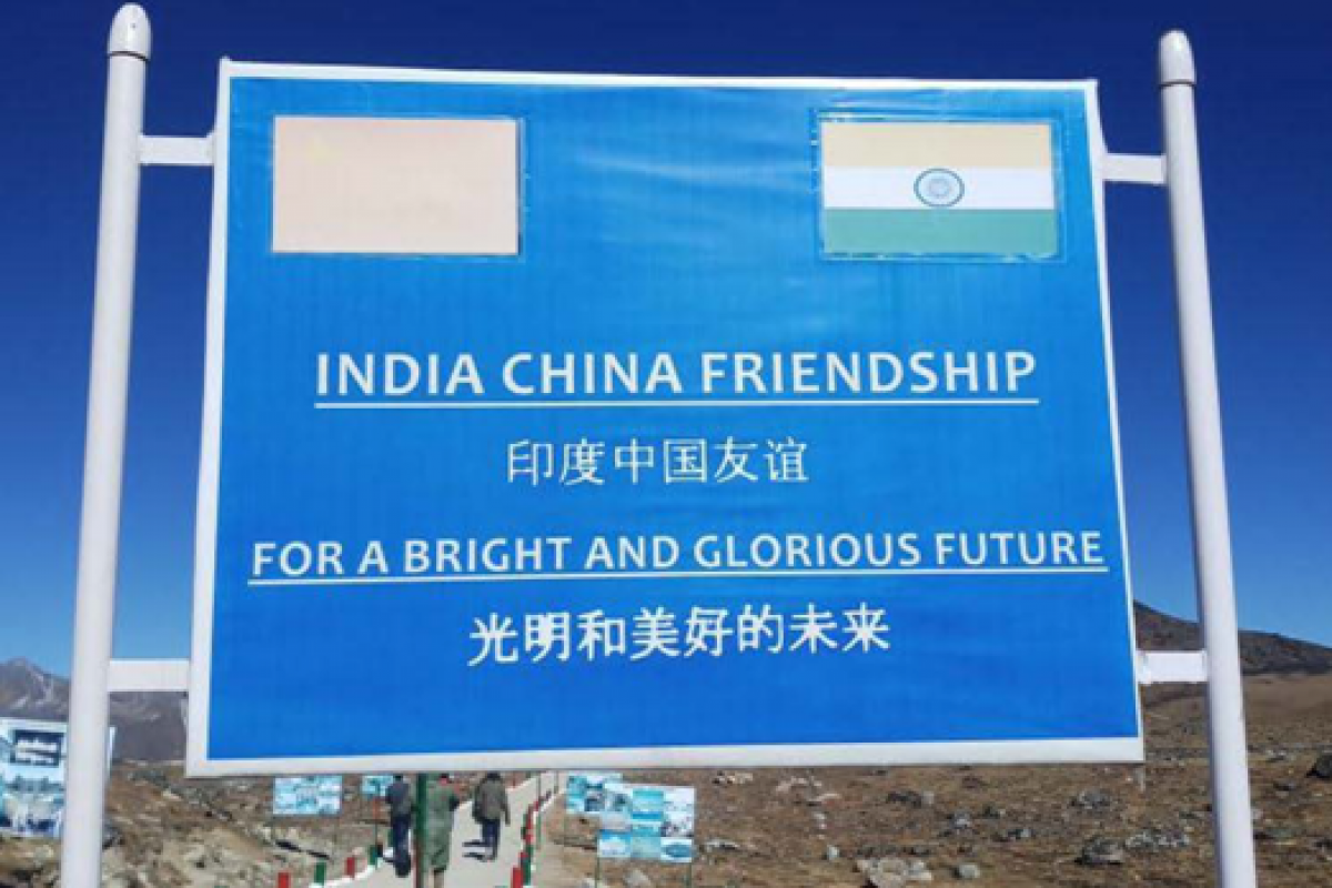
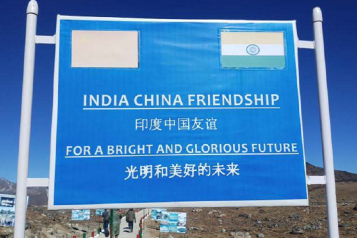
Bum la Pass
The Bum la or Bumla pass, situated at an altitude above 15000 feet, is located approxi-mately 37 kms. north of the district headquarters, with an approximate driving time of 2 hours. Due to it’s towering elevation, the pass in snowbound for almost the entire year and presents a beautiful view of the Tibetan plateau.
As the Line of Actual Control (LAC) is a de-facto border, there is no border fence at the pass. It is one of the four officially agreed BPM (Border Personnel Meeting) points between the Indian Army and the People’s
Liberation Army of China where regular Border Personnel meets On designated dates, cultural programmes are also organized by the two sides, which can be witnessed by the people.
A special permit is required for visiting the Bum La Pass (Bhalukpong- Bomdila-Dirang-Tawang permit doesn’t allow to go to Bum La), which can be obtained from the Office of the Deputy Commissioner, Tawang and after completion of the formalities there, it has to be stamped at the Brigade headquarters near the War memorial.
One needs to hire a separate local vehicle for this stretch.
Only Indian nationals are allowed to visit Bum la Border.
Gorichen peak
The highest peak in the region with a height of 22,000 fts., the Gorichen peak has fascinated the minds of many mountaineers to scale it. It is at a dis-tance of 164 kms from the main town. It is locally known as Sa -Nga-Phu. The peak is visible from Kaziranga, it is said that the peak is also visible even from Shillong.
Geshela peak
Though not very high, the peak is more approach-able as compared to Gorichen peak as it is only 25 kms away from Tawang. One can plan a picnic there in consultation with the Hotel Management.
Tsong-Tsong- La peak
The Tsong-Tsong -La peak is located at distance of 90 km from Tawang in Bongkhar at a height of 14,000 fts.
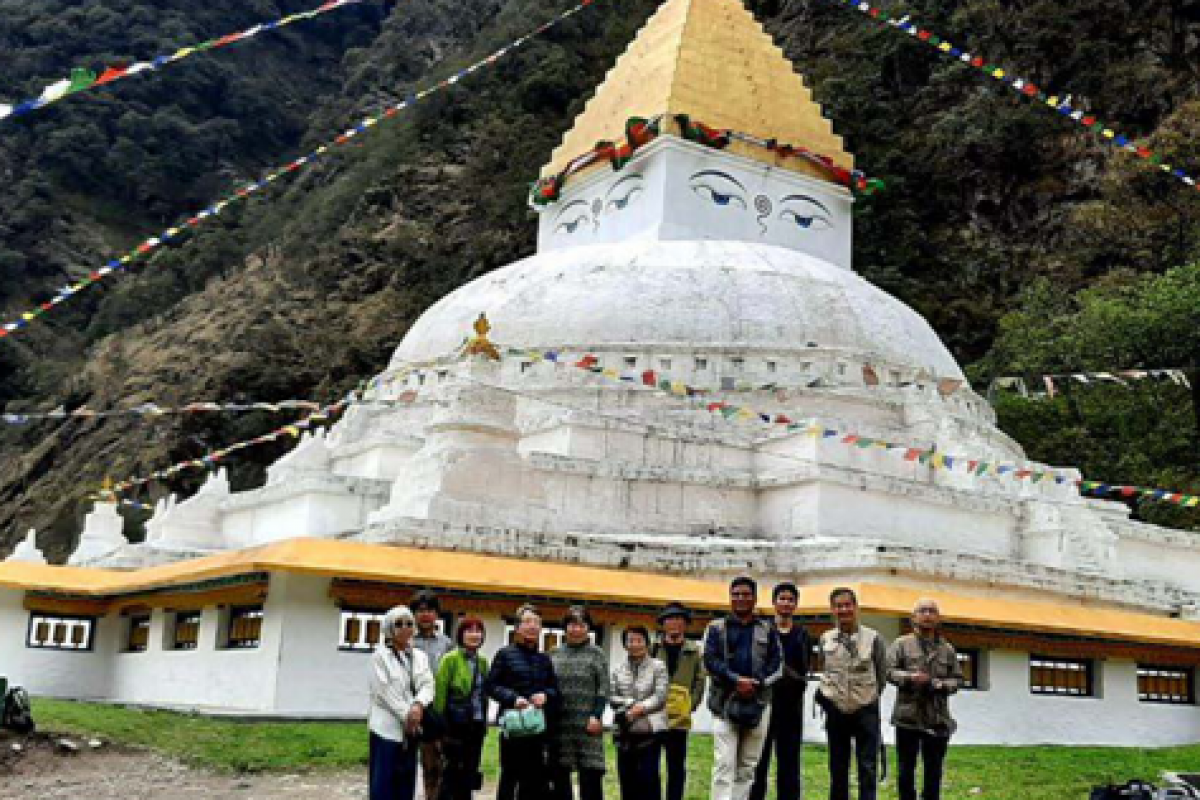
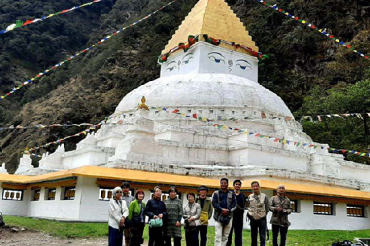
GORZAM CHORTEN ZEMITHANG
The sky looming high stupa about 92 Km from Tawang was constructed by Lama Prathar from Kharman village in Zemithang, in 13th Century A.D., it stands featuring 186 feet base and 93 feet high is the modeled after Boudhinath stupa of Nepal.
Thousands of devotees visit during Gorzam Kora festival to observe the virtuous occasion during the last day of the first month of the lunar calendar. One needs to hire a separate local vehicle for the excursion.
Sangestar Tso Lake
(also known as Jhongatser lake or Madhuri Lake )
This astoundingly beautiful and unique lake is located about 42 kms from Tawang. The lake was once part of a valley covered with pine trees. The lake was formed as a result of a depression created by the earthquake that occurred in 1950.
Nestled between picturesque mountains, the lake still has the dead and dried tree stumps on its bed that jut out like poles all over the lake, giving it a very distinct look. During winters, the lake is covered by a thick sheet of snow. It is home to the snow pigeon and the musk deer. One needs to hire a separate local vehicle for this stretch.
Chagzam Bridge
Tangton Gyalpo, a disciple of first Dalai Lama, popularly known as
Lama Chag-Zam Wangpo (1385-1464) was an architect, Philosopher and an Iron chain bridge builder.
He is credited to have built more than 100 iron bridges all over Hi-malayan region.
During 1420-1430 he built the bridge over Tawang-chu river to make a passage through Kitpi and Mukto. The bridge that exempli-fies the finest metallurgy is about 25 Kms away from the Tawang town.
Best time to visit Tawang
Tawang remains cool the year round - with November to Feb-ruary being the coldest months.
The weather is ideal from March until the onset of monsoon in June and then again in Octo-ber-November. Summers are pleasant while the monsoon months are relatively cooler. When winter sets in - in mid-Oc-tober - one can enjoy the beauty of a snow-covered landscape.
The average maximum and min-imum temperatures vary between 15 and -5 degree Celsius at this time and one might need to let snowfall plan the travel sched-ule. It is advisable to carry heavy woolens, sunglasses, raincoats / umbrellas. From November until mid February, Tawang is extremely cold. The road to Sela Pass is cov-ered in snow.
Landslides and heavy snowfall blocks the Pass temporarily but thanks to the Border Road Organi-sation, they get cleared soon.
Expect mixed experience in hotels at Bomdila-Dirang -Tawang sector.
Tawang once the ‘Hidden Paradise’ has opened up to the world and is growing steadily. It has witnessed marked improvement in the standard of living of its people, development of human re-sources and infrastructure.
Given the remoteness of the sector, accommodations and meals range between average and good and most of the hotels are without elevators. Hotels arrange for room heat-ers for an extra charge, but due to power fluctuations they may not work all times of the day and hot water supply is limited.
It is advisable for tourists to carry power bank for mobile and additional batteries for camera.
It is a standard practice for hotel staff in the sector to ask you for your exact meal re-quirements based on the standard menu on offer for the day or next day. It is a good idea to be punctual since restaurants in hotels are not keen to re-warm your meal once it has been readied at the time you specified. It is also a good practice to men-tion/specify the time when you intend visiting the hotel's dining room.
The Road Trip
Guwahati -Tawang-Guwahati - is for those who enjoy exploring. This is a long road trip and the total distance from Guwahati to Tawang is around 525 kms - which cannot be covered at one stretch. So, one has to factor in minimum two night halts before reaching Tawang. The route from Bomdila to Dirang and Dirang to Tawang is a te-dious drive.
Guwahati to Tawang and back will require minimum of 5nights / 6 days (provided tour-ists arrive Guwahati airport in the early morning & depart late in the evening from Guwahati airport) or plans can be made up to 8 days as well and additional two nights for Kaziranga trip if tourists are travelling between November and April (Kaziranga, Nameri, Manas National Parks and Pobitora Wildlife Sanctuary are open for tourists from No-vember to April i.e., for 6 months).
However, the beautiful scenery on the way and the untouched route Bomdila-Dirang-Tawang will make one forget the strain. It is one journey that gives an opportunity to get away from the mundane and the urban.
Helicopter Service
Helicopter services from Guwa-hati to Tawang or vice -versa are not recommended as confirma-tion of reservation is made before the departure of the scheduled trip and may also get cancelled at the last minute due to weather condition. Helicopter rides in the region are not very reliable and are always subject to weather changes.
Entry formalities
To visit Arunachal Pradesh all tourists would require Inner Line Permits (ILP) or Protected Area Permits (PAP) . Indian tour-ists require ILP and foreign tourists require PAP.